
LIDAR
LIDAR(Laser Detection And
Ranging) 촬영 및 3D 스캐닝

RGB-Depth 분석
색상과 공간 정보를 동시에 캡쳐하여
환경에 보다 정교한 분석 및 이해

열화상카메라
온도 감지로 산불감시, 구조활동,
노후설비 등 안전위협요소 파악

Multispectral
다분광이미지-멀티퍼스펙트랄
(Multispectral) 이미징
PORTFOLIO
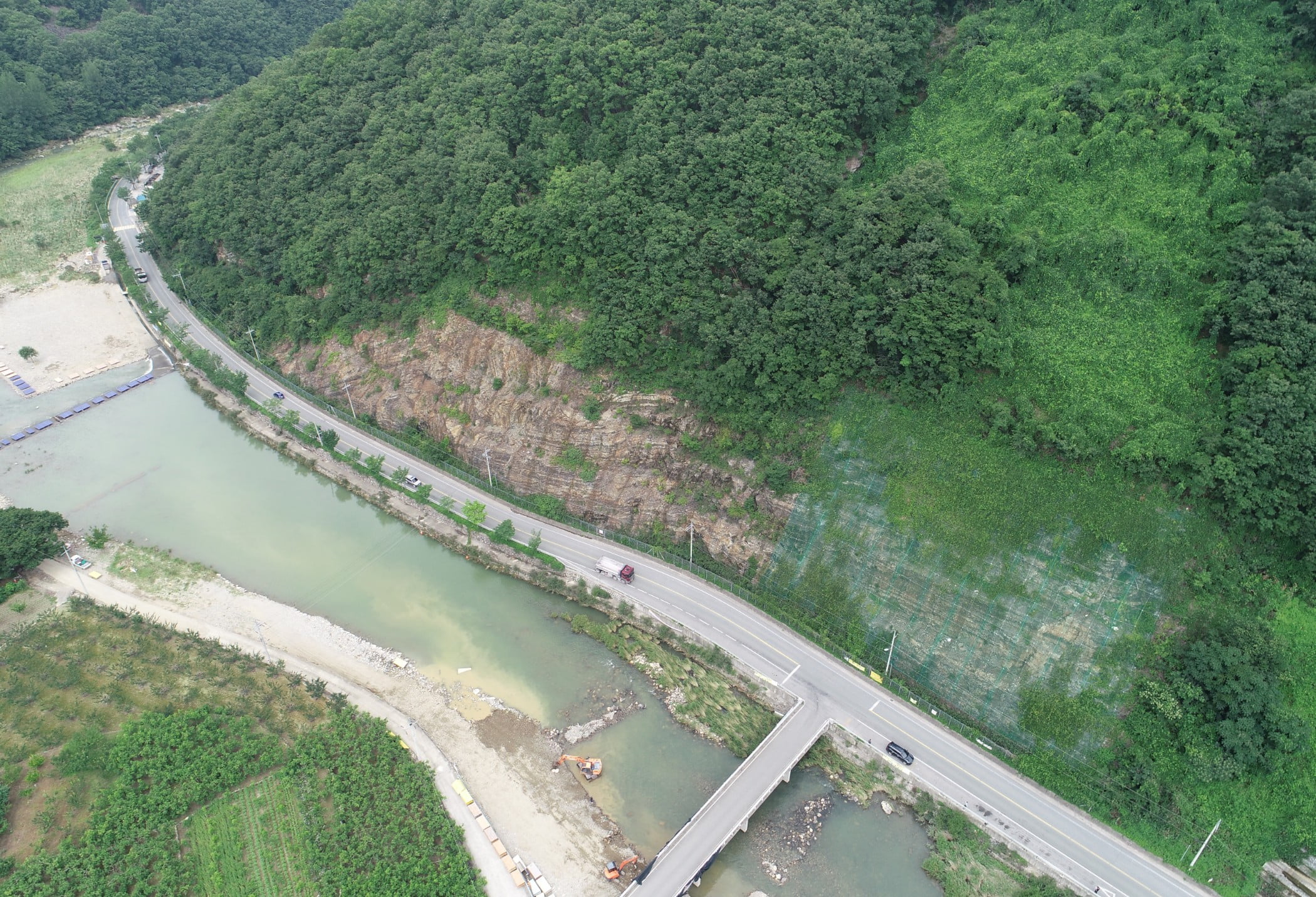
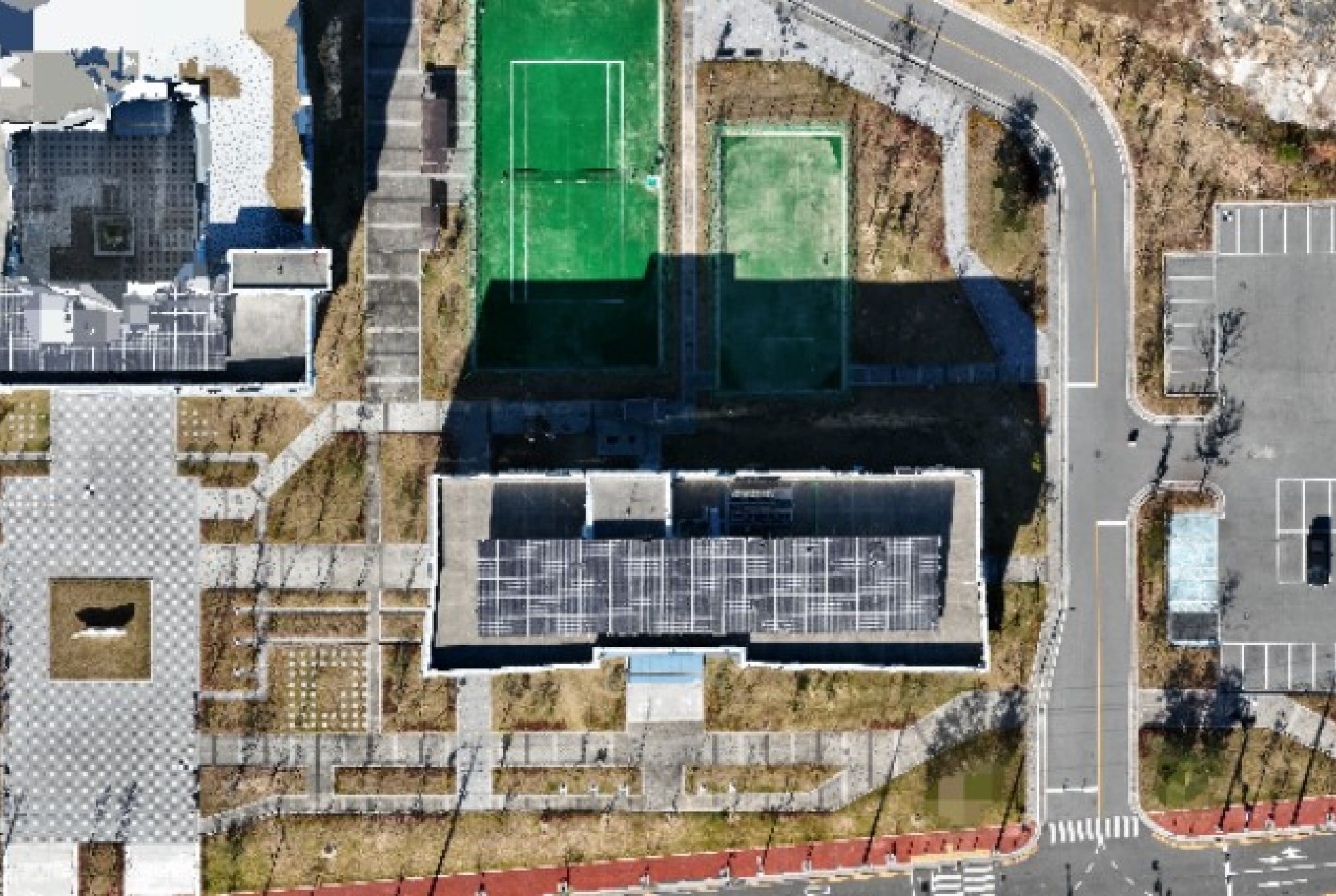
사면촬영
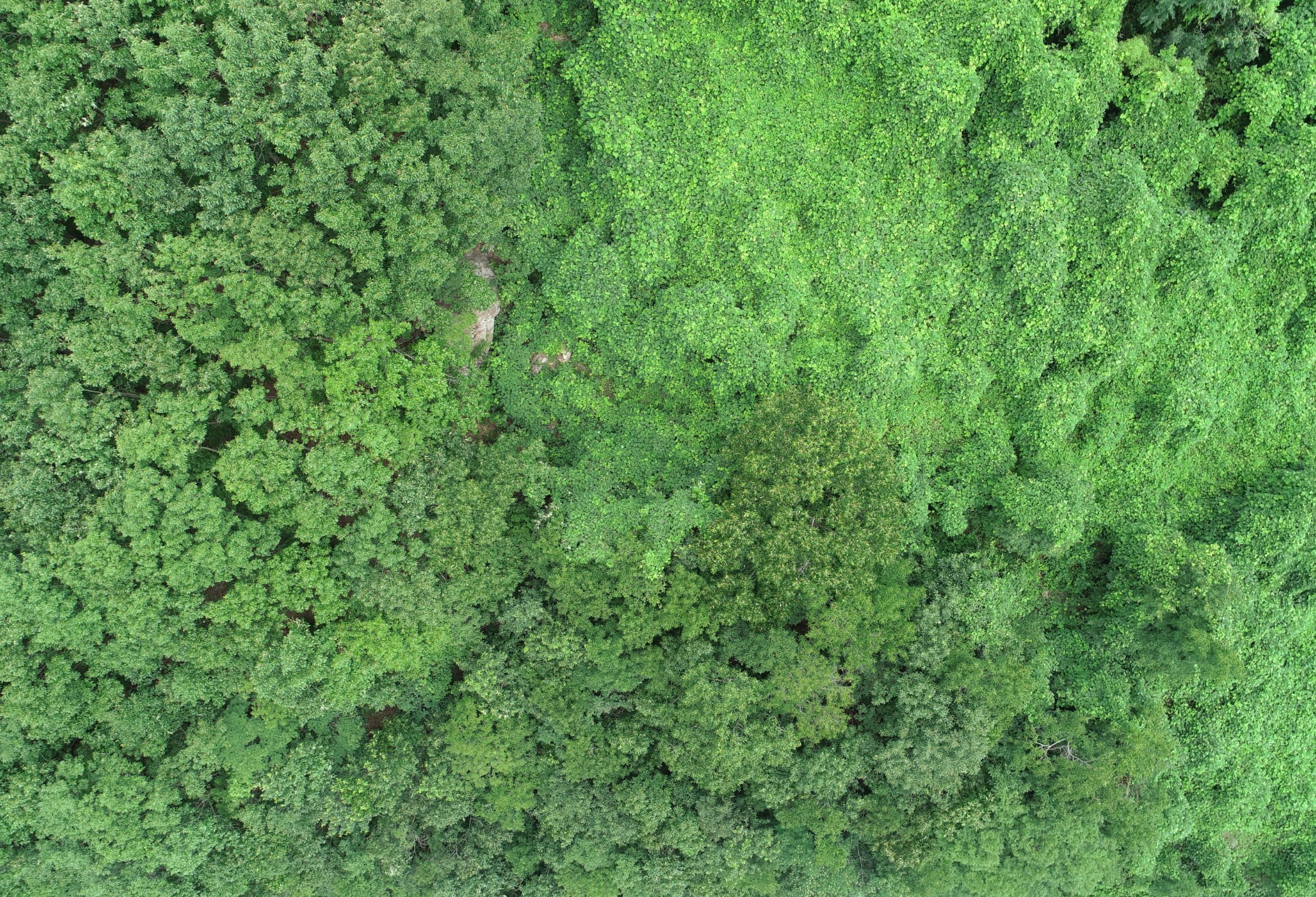
산림감시
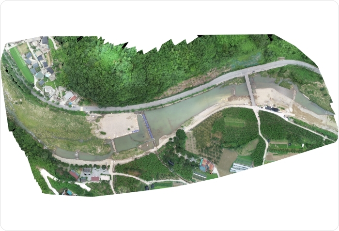
지형매핑
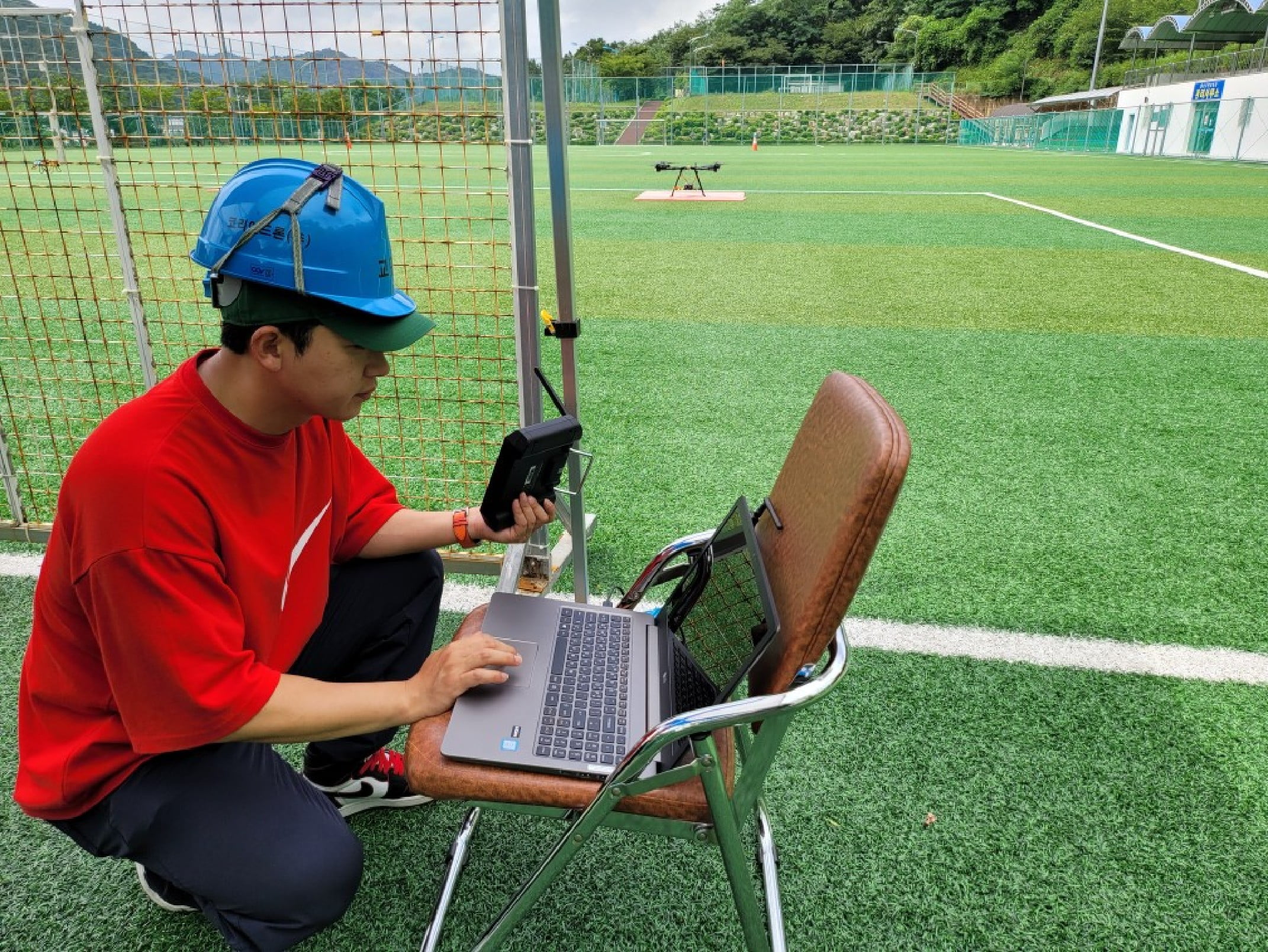
픽스호크장비(자율비행)
SURVEYING 측량
| Ortho projection name | Ortho projection 1 |
|---|---|
| Component name | Component 0 (1) |
| Geo-referenced | True |
| Has Digital Terrain Model | False |
| Rendering method | True ortho from a textured model |
| Width [pixels] | 718 |
| Height [pixels] | 382 |
| Units per column pixel | 0.230757 |
| Units per row pixel | 0.230971 |
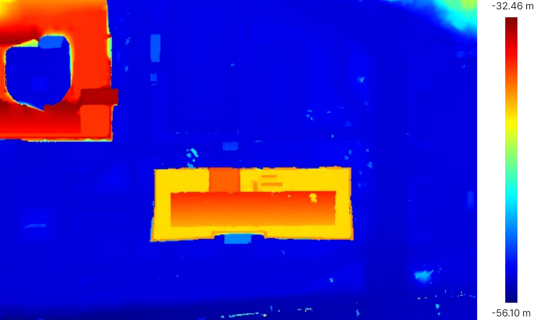
| Bounding box depth (length in the x direction) | 165.683430 m |
| Bounding box width (length in the y direction) | 88.230794 m |
| Bounding box height (length in the z direction) | 26.440908 m |
| Cut Volume | 97530.38 ㎥ |
| Fill Volume | 288992.89 ㎥ |
| Area 2D | 14559.81 ㎡ |
| Area 3D | 23959.92 ㎡ |
| Coordinate system | epsg:4326 - GPS (WGS 84) |
| Ortho projection type | Top |
| Projection | Lat/long (Geodetic alias) |
| Bounding box centre in epsg:4326 - GPS (WGS 84) Coordinate system |
lat: 35° 4' 11.6347'' N lon: 128° 34' 33.6326'' E alt: -44.481478 m |
| Corners in epsg:4326 - GPS (WGS 84) Coordinate system |
NW: lat: 35° 4' 13.0663'' N , lon: 128° 34'30.3628'' E NE: lat: 35° 4' 13.0662'' N , lon: 128° 34' 36.9023''E SE: lat: 35° 4' 10.2032'' N , lon: 128° 34' 36.9023''E SW: lat: 35° 4' 10.2032'' N , lon: 128° 34'30.3628'' E |
| Prime meridian | greenwich |
| Units | Meter |
| Image and DSM rasterization time | 00h:00m:04s |
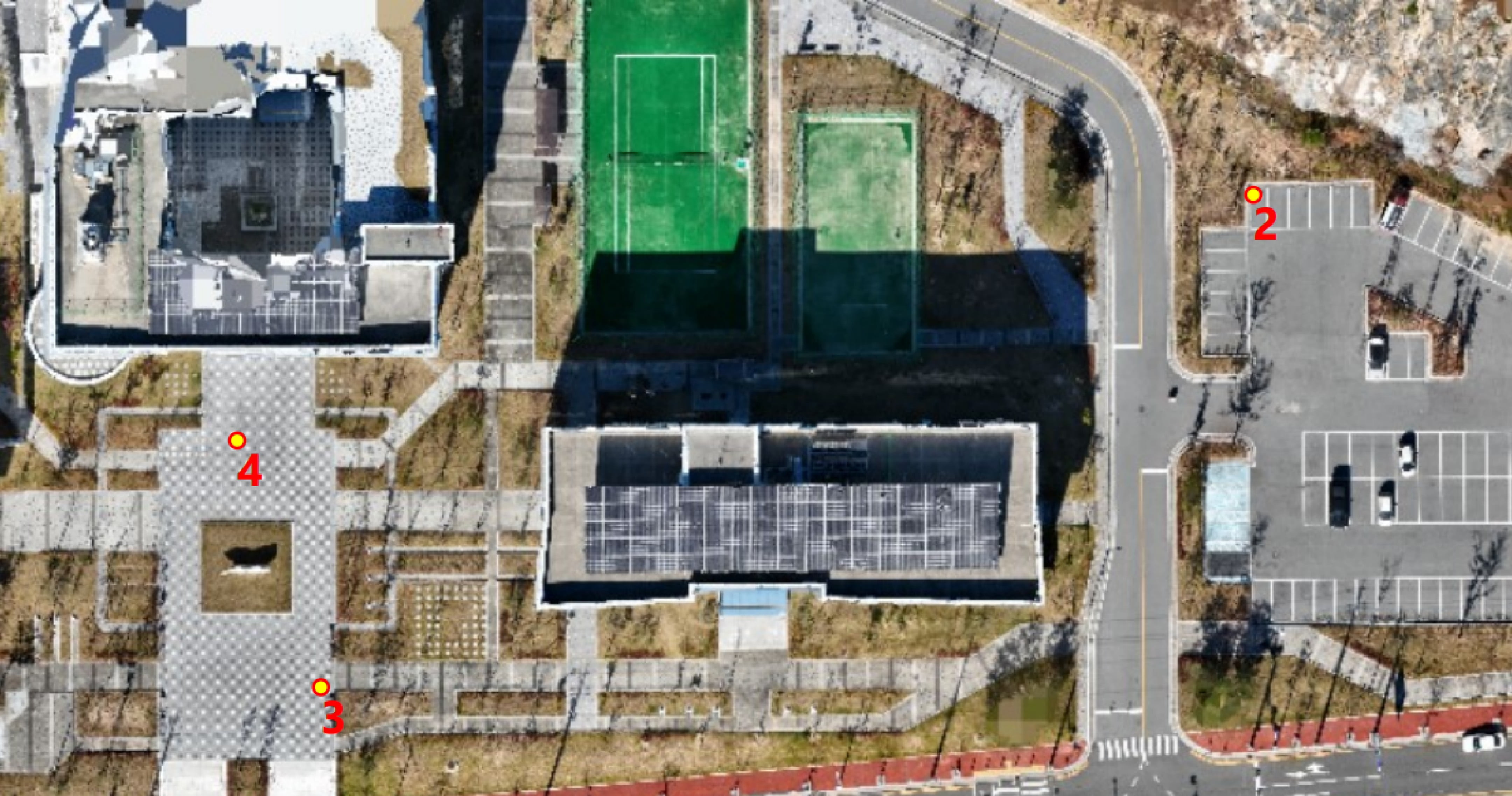
| Name | Type | Weight |
Coordinate system |
Imported coordinates |
Actual positon |
#Images |
Total deviation (Error X; Error Y; Error Z) [m] |
Meximal projection eorror [pixels] |
|---|---|---|---|---|---|---|---|---|
| 2 | Grenad control | 10 |
epsg:4326 - GPS (WGS 84) |
at: 35° 4' 12.3744''N lon: 128° 34'35.8032'' E alt: -53.920 m |
lat: 35° 4' 12.3744''N lon: 128° 34'35.8032'' E alt: -53.920 m |
16 |
0.001 (0.000; 0.001; -0.000) |
0.71 |
| 3 | Grenad control | 10 |
epsg:4326 - GPS (WGS 84) |
lat: 35° 4' 10.6212''N lon: 128° 34'31.7568'' E alt: -53.992 m |
lat: 35° 4' 10.6211''N lon: 128° 34'31.7569'' E alt: -53.995 m |
14 |
0.004 (-0.003; 0.002; 0.003) |
0.23 |
| 4 | Grenad control | 10 |
epsg:4326 - GPS (WGS 84) |
lat: 35° 4' 11.4996''N lon: 128° 34'31.3932'' E alt: -54.003 m |
lat: 35° 4' 11.4997''N lon: 128° 34'31.3931'' E alt: -54.004 m |
22 |
0.003 (0.001; -0.002; 0.001) |
0.40 |


